Tropical Storm Isaias forecast to make landfall as hurricane Friday
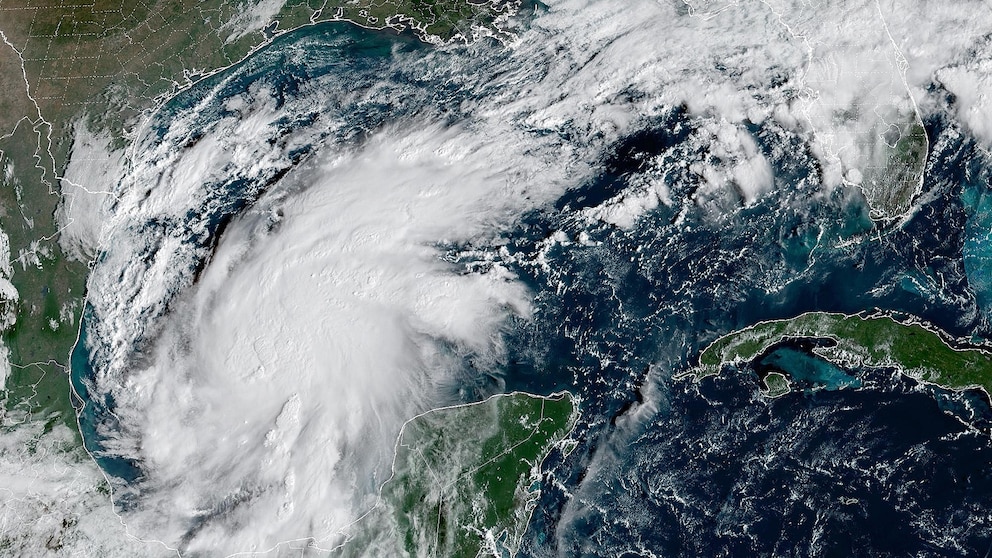
Tropical Storm Isaias, which is churning hundreds of miles south of the Gulf Coast, is expected to rapidly strengthen in the next 24 to 48 hours before making landfall on Friday as a hurricane.
The National Hurricane Center issued hurricane watches and storm surge watches Wednesday morning for parts of the north central Gulf Coast.
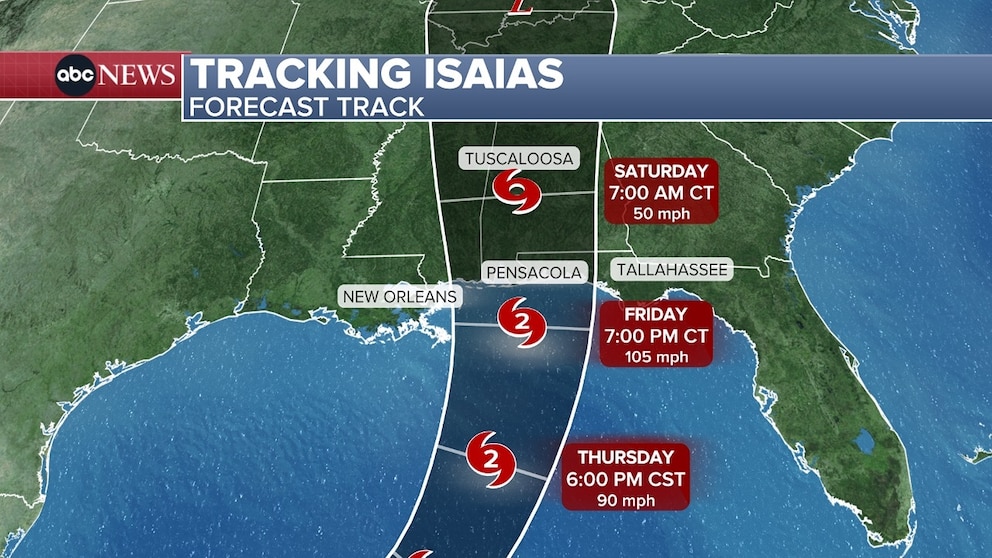
The storm on Wednesday morning was about 580 miles south of the Mississippi River. It may become the first Atlantic hurricane of the season, the latest first hurricane on record, on Thursday.
The hurricane watch is in effect for coastal Mississippi, coastal Alabama, and the western Florida panhandle. Winds could gust 70 to 100 mph for this region.
The storm is expected to make landfall as a 1 or 2 category hurricane on Friday sometime between 5 p.m. local time and midnight.
Rain from Isaias may reach the New Orleans-to-Pensacola region along the Gulf Coast on Friday morning, bringing with it potentially tropical-storm-force winds.
Storm surges -- abnormal rise in sea level caused by storms -- could reach 7 feet in parts of the Mississippi and Alabama coasts, and up to 5 feet on the western Florida panhandle.
Large and dangerous waves are expected to accompany the surges on the coast near and to the east of the storm's landfall location.
Flooding from the surge can vary greatly over short distances depending on the timing of the surge and tidal cycle.
This is a developing story. Please check back for updates.